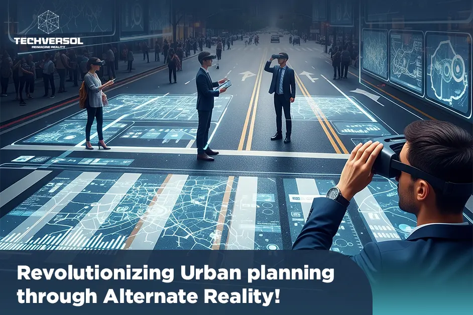
Urban planning is on the verge of a transformative leap, fueled by the combination of alternate reality (AR) technologies. Alternate realities technologies containing Virtual Reality (VR) and Augmented Reality (AR), are revolutionizing how we design, conceive, and visualize urban spaces. Techversol’s architectural visualization services and this paradigm shift are optimizing planning processes, improving architectural innovation, and redefining stakeholder engagement in once unthinkable ways.
We will not only be poised to provide you with architectural visualization services but also explain to you the impact of alternate reality on urban planning, exploring its applications, benefits, and future potential.
Understanding Alternate Reality Technologies:
It is essential to capture the significance of architectural visualization and alternate realities and their technologies, VR and AR, before discussing their impact on urban planning:
Virtual Reality (VR):
VR engages users in a thoroughly digital environment. Users can interact with and explore computer-generated simulations as if they were present physically through VR headsets. VR is effective, particularly in creating immersive, detailed, and architectural visualizations of urban spaces and architectural designs.
Augmented Reality (AR):
AR overlays digital information onto the real world. Users can see digital objects or data superimposed on their physical environment by using AR devices or smartphone apps. AR is invaluable for architectural visualization, to visualize how new developments or changes will blend into existing spaces.
Enhancing Design Processes with VR:
VR has transformed the architectural design process significantly by providing effective, three-dimensional experiences that go beyond traditional 2D blueprints and 3D models. Urban planners and architects can now able to:
Visualize Designs in Context:
VR allows architects to experience and create virtual walkthroughs of public spaces and buildings, allowing designers to understand how various elements, like lighting, materials, and spatial arrangements, interact within the project’s context. Architects can specify optimized layouts, and design flaws, and make well-informed decisions before actual construction begins by experiencing these simulations.
Engage in Real-Time Collaboration:
Teams can collaborate in a shared virtual environment, regardless of their physical location with VR, useful for large-scale projects involving multiple stakeholders. Clients, Architects, and engineers can meet in a virtual space to concern and adjust designs in real-time which leads to more efficient problem-solving and decision-making.
Refine User Experience:
VR allows architects to simulate how users will experience a specific space. Designers can consider aspects like spatial flow, comfort, and functionality by walking through a virtual model. For instance, they can assess how natural light will interact with internal spaces at various times of the day or how acoustic design influences the surroundings of a public area.
AR and Stakeholder Engagement:
AR plays a critical role in improving public participation and stakeholder engagement in urban planning:
Visualizing Proposals in Context:
AR enables planners to overlay digital representations of new developments onto physical world surroundings. For example, during community gatherings or public consultations, planners can utilize AR to demonstrate how a suggested building or park will suit the current neighborhood. This contextual architectural visualization allows stakeholders and residents to understand the impact of the project more clearly, leading to more informed feedback and discussions.
Interactive Public Consultations:
AR improves the interactive nature of public consultations. Planners can use AR to create dynamic, interactive presentations that allow participants to explore different aspects of a project rather than depending on static images or drawings, helping fill the gap between technical experts and the general public, and encouraging greater trust and transparency.
On-Site Visualization:
AR can be utilized on construction sites to overlay digital plans or models onto real spaces, assisting in real-time decision-making, and allowing planners to see how design modifications will influence the existing environment and make adjustments as required. It also allows construction to perfectly align with the intended design, reducing errors and rework.
Simulating Future Urban Environments:
One of the most effective benefits of technology of alternate realities is their ability to simulate and test different scenarios for future urban environments:
Scenario Analysis:
VR simulations can model various urban scenarios, like environmental impacts, traffic flow changes, and emergency response strategies. Planners can explore how these scenarios will influence the functionality and make data-driven decisions for the city to address potential problems.
Predictive Modeling:
AR can overlay projections and data onto real-world spaces, offering insights into future conditions, valuable for assessing the influence of planned developments on factors such as traffic patterns, energy consumption, and environmental sustainability. Planners can utilize these insights to optimize designs and implement techniques that perfectly align with long-term urban objectives.
Adaptive Planning:
Alternate reality technologies allow adaptive planning by simulating various scenarios and results. Urban planners can experiment with various design options and assess their effectiveness before committing to a final plan. This iterative strategy allows for more responsive and flexible planning that can adjust to modifying requirements and conditions.
Enhancing Accuracy and Reducing Costs:
The integration of technologies of Alternate Reality into urban planning also contributes to significant accuracy and cost savings:
Enhanced Design Accuracy:
VR simulations offer a thorough view of the design of the project, allowing architects and planners to specify potential issues early in the process. This early detection of design faults decreases the probability of costly changes during construction and ensures that the outcome perfectly aligns with the intended vision.
Cost-Effective Planning:
AR can assist and facilitate the process of planning and construction by lessening the demand for physical prototypes and mock-ups. Planners can use AR to visualize and test designs virtually rather than building physical models or conducting numerous site visits. This strategy saves time and resources making the planning process more cost-effective and efficient.
Minimizing Errors:
AR-assisted on-site reviews ensure that construction adheres to the design specifications. Planners can demonstrate that work is being completed accurately and address any discrepancies promptly by overlaying digital plans onto physical structures.
The Future of Urban Planning with Alternate Reality:
Alternate reality’s role in urban planning is expected to expand further as their technologies continue to advance:
Mixed Reality Integration:
The future may see the integration of mixed reality, which combines elements of alternate reality technologies. Mixed reality could allow planners to interact with digital models and physical environments, offering even greater flexibility and accuracy in the process of design and planning.
Increased Accessibility:
The use of alternate reality technologies in urban planning will likely become more widespread as VR and AR technologies become more affordable and convenient, empowering community organizations, smaller firms, and local governments to participate in the planning process, and promoting greater inclusivity and innovation.
Enhanced Data Integration:
Future developments may enclose advanced data integration capacities, enabling planners to integrate real-time data from different sources into their simulations, enhance the accuracy of predictions, and support more informed decision-making.
Conclusion:
Techversol’s architectural visualization as well as alternate reality technologies are revolutionizing urban planning by enhancing design processes, enhancing stakeholder engagement, and allowing more accurate simulations of future environments. VR and AR offer influential tools for urban planners and architects to visualize, test, and refine their projects, resulting in more efficient, cost-effective, and responsive planning.
FAQs:
What does your 3D architectural animation service provide?
Our 3D architectural animation services create a short, computer-generated movie of a building or architectural design.
What software is used for 3D architectural rendering?
Autodesk 3ds Max is a key tool for architecture 3D modeling and rendering. It has a powerful set of polygonal modeling tools and parametric modeling features that enable non-destructive editing and allow for easy experimentation and design exploration.
What is exterior 3D architectural exterior rendering?
Exterior rendering creates three-dimensional visuals that show the exterior design of architectural projects to be built.
Get your vision to life and see your designs in stunning detail. Click below to get our expert architectural visualization services.